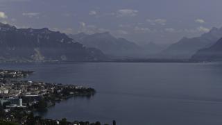

Walking Around Lugano City (Lake Lugano)
Scenic lakeside trails with alpine views
- Where
- Lugano, Ticino
- Directions
- Directions
Lugano is one of the easiest Swiss cities to explore on foot, since the main sights lie within a few kilometres of each other along the lake and between steep hills. The centre is compact, hills rise directly behind it, and most routes can be walked in either direction, so there is no single correct way to do it. Three outings, from easy to energetic, cover most of what a visitor would want to see, and each can be done in a morning or an afternoon.
The first walk is the classic one along the water. Start at the lakefront near Paradiso, on the western side, where the funicular to Monte San Salvatore begins, and walk east along the shore, past the landing stages and the cultural centre LAC, to Parco Ciani, with its lawns and old trees. The path is flat and paved, with benches and cafés, and the whole distance takes about an hour at a gentle pace. You can continue past the park toward the Cassarate river, where the city's eastern suburbs begin. This route is particularly lovely in the early evening, when the light turns warm and local people come out for the passeggiata, the traditional evening stroll.
The second outing goes through the old town. From the lake, walk up Via Nassa under the arcades to Piazza della Riforma, then through the lanes toward Piazza Cioccaro and the steps up to the cathedral of San Lorenzo. From the cathedral terrace there is a view over the town, and from there you can descend to the church of Santa Maria degli Angioli, with its large Renaissance fresco. This walk is short, around an hour, but with plenty to look at, and the streets are mainly pedestrian. Cafés and shops line the route, so it is easy to stop for a coffee or an ice cream.
The third outing leaves the city. The Olive Trail, a signposted path, runs along the northern shore of the lake from Castagnola, on the eastern edge of Lugano, to the village of Gandria, passing olive trees, stone walls and views of the water, in about an hour of walking. Many walkers return by boat from Gandria. For a bigger effort, the two mountains that frame the city, Monte Brè and Monte San Salvatore, can be climbed on foot or reached by funicular, and both offer wide views over the lake and the Alps. Smaller green spaces such as the hillside Parco del Tassino near the station give a view over the town for a short climb.
All these walks are free and need no tickets, apart from the funiculars and boats. Wear comfortable shoes, since paving can be steep or uneven, and bring a hat and water in summer. Weather in Lugano can change quickly, with heavy showers in spring and autumn, so check the forecast before a longer walk. The city's public transport, including buses and the funicular to the station, makes it easy to shorten a route or to return when tired. Walking suits all ages, and a day of linked walks can be rounded off with dinner in the old town, where menus mix Ticino and Italian dishes.
Categories

More photos coming soon
Nearby Attractions
Other places to visit in Lugano

Lake Lugano
Alpine lake with Mediterranean villages and cruises
Natural Wonders · Boat Tours
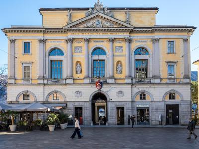
Lugano Old Town
Historic piazzas and Renaissance frescoes
Cultural Experiences · History & Heritage

Monte San Salvatore
Panoramic views, hiking trails, and funicular ride
Natural Wonders · Mountains
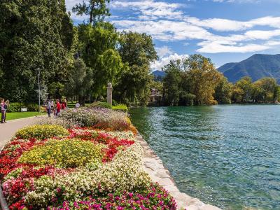
Parco Ciani
Lakeside park blending Italian gardens and wild woods
Natural Wonders · Urban Exploration
Questions people ask
Quick Facts
Best Time to Visit
April to October offers mild weather, blooming gardens, and ideal conditions for lakeside walks, outdoor dining, and exploring Lugano’s attractions.