

- Where
- Aargau, Aargau
- Directions
- Directions
The Reuss River is the main reason Bremgarten looks the way it does, and Bremgarten’s whole character comes from the bend. The river rises in the Alps, flows out of Lake Lucerne at Lucerne and runs north through the Aargau lowlands to join the Aare, and at Bremgarten it makes a tight loop. The medieval town sits on the inner side of the bend, on a spur of land that the river almost encloses, with water on three sides and a single narrow neck of land leading in from the fourth. That position made the settlement easy to defend and was the reason a fortified town was founded here in the Middle Ages, and the plan of the old town still follows the shape of the peninsula.
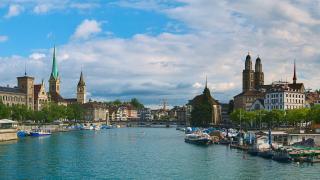
A walk along the river is the best way to appreciate the setting. A path runs beside the water below the town walls, and from different points you see the old town rise above the Reuss in layers: stone walls and gardens at the bottom, rows of tall houses with steep roofs above them, and towers and gates breaking the skyline. The view from the opposite bank, looking back across the water, is the classic picture of Bremgarten, with the reflections in the slow green current on a calm day. The river is wide and fast enough to feel powerful, and near the weir you can hear the water before you see it.
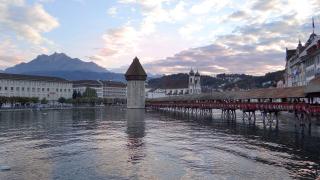
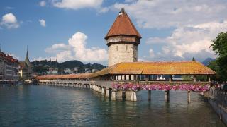
The covered wooden bridge is the best-known crossing. It links the old town to the far bank and is a long timber structure with a roof, one of the few of its type that still carry traffic of some kind in this part of Switzerland. Crossing it gives a changing view up and down the river, and the interior has the creak and the shade typical of a covered bridge. A stone tower stands at the town end, and a gate tower and a chapel complete the picture. Nearby are the old town’s arcades, small shops and cafés, which makes it easy to combine a river walk with a coffee.
The Reuss is also a place for outdoor activities. Cyclists use the riverside paths, which are part of long regional routes, and walkers follow the banks upstream or downstream into the Reuss valley, where restored floodplain areas shelter birds and other wildlife. Paddlers use the river in summer, but it has currents and weirs, so inexperienced people should go with a guide or a club. Anglers fish from the banks, and families picnic on the grass by the water. Floods occasionally affect the lowest parts after heavy rain.
The Reuss walk suits couples, families, cyclists and photographers. It costs nothing and can be done in an hour or an afternoon. Combine it with a look at the old town’s gates and arcades and the other attractions in Aargau, such as the castles and Aarau.
Categories

More photos coming soon
Nearby Attractions
Other places to visit in Aargau
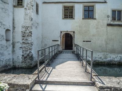
Schloss Hallwyl
Moated 12th-century castle in Aargau, Switzerland
Cultural Experiences · History & Heritage

Aargauer Kunsthaus
Swiss art from 18th century to today
Cultural Experiences · Museums
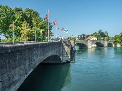
Old Rhine Bridge Rheinfelden
Historic stone bridge spanning the Rhine in Rheinfelden
History & Heritage · Urban Exploration

Thermal Spas Of Aargau
Thermal springs and wellness baths in Aargau
Activities & Adventure
Questions people ask
Quick Facts
Best Time to Visit
May to September offers mild weather, blooming landscapes, and ideal conditions for hiking, sightseeing, and exploring Aargau’s castles and towns.